
Drone/UAS Services
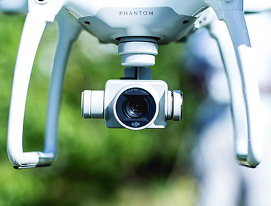
AESI offers comprehensive unmanned aerial system (UAS) services that provide our clients with accurate and timely imaging, mapping, analysis and monitoring throughout their construction projects. We utilize a DJI Phantom 4 RTK drone with an extremely high resolution camera and Global Positioning built in. The drone includes real-time kinematic (RTK) positioning, which uses satellite-based positioning systems to provide imaging and mapping that’s accurate to several centimeters. The onboard camera can capture 4k imagery and UHD video to provide highly detailed photographs and videos. Our Federal Aviation Administration (FAA)-certified pilots use the DJI Phantom 4 RTK drone along with Pix4D professional photogrammetry software to provide our clients with superior drone products and services. AESI maintains high levels of professional and general liability insurance for the operation of our drones.
Service Offerings
• Site Photographs
• Aerial Video Photography
• Topographic Mapping (Contours)
• Construction Site Monitoring
• Integration of Aerial Photography
into CAD Mapping & GIS Systems
• Pavement Condition Analysis
• Damage Assessments
• Infrastructure Surveys
• 3D Fly-Through Models
• 3D Digital Terrain Models (DTM)
with elevations for CAD or GIS
Benefits of Using Our Drone Imaging
Community Outreach: When you’re working on a public project, sharing drone videos and photos at meetings or on your website can increase awareness of the project, foster trust and increase stakeholder buy-in.
Integration with GIS System: Our drones will capture up-to-date aerial photography that we can integrate into your GIS mapping program. All imagery data is referenced to standard coordinate systems to allow for overlaying of other industry standard data layers such as parcels, water lines, buildings, etc.
Project Visualization: When you use a drone, you can get photos and videos from all angles and create 3D models that make it easier to see the project’s progress at different stages or visualize existing infrastructure.
Arrow Infrastructure Solutions Inc. DBA Arrow Engineering Corp. | 42138 10th St. W, Lancaster, CA 93534 | (661) 949-2525